Salt marshes keep up with sea level rise in two ways: they build elevation by trapping sediment and organic matter, and where the land behind them is open, they migrate inland. The second route is the one that usually gets blocked first.
That is the short answer. Everything below is the mechanism behind it, the rates involved, and the point where it stops working.
Table of Contents
- What does it mean for salt marshes to keep up with sea level rise?
- How do salt marshes build elevation?
- Why do marsh plants matter for keeping pace?
- Can salt marshes migrate inland as the sea rises?
- What limits how well a salt marsh keeps up?
- Sediment shortage
- Subsidence and compaction
- Too much sediment, counterintuitively
- A blocked migration corridor
- Loss of the vegetation engine
- Do salt marshes protect coasts from flooding and erosion?
- How do scientists measure whether a marsh is keeping up?
- What can people do to help salt marshes adapt?
- Frequently Asked Questions
- How fast do salt marshes accrete?
- Can salt marshes survive sea level rise?
- What is a sediment elevation table?
- Why do marshes need to migrate inland?
- Is adding sediment always good for a marsh?
- What to do first
What does it mean for salt marshes to keep up with sea level rise?
Keeping up means the marsh surface rises at least as fast as the water around it. If water climbs faster than the ground, tidal plants spend longer in deeper water, stress, die back and disappear.
Marsh plants only survive inside a narrow band of heights relative to mean sea level. Too low and they drown. Too high and they dry out and get overtaken by upland species. Elevation is the whole ballgame.
Marsh health is measured against local relative sea-level rise, not the global average. Relative rise is the sum of three things: the rising global ocean, regional changes in ocean circulation, and vertical movement of the land itself. Where the crust or sediment beneath the marsh is sinking, relative rise is faster than the global number people see in the news.
Savannah, Georgia, is a good illustration. Its tide gauge has registered more than seven inches of rise since 2010, one of the fastest local rates in the country. That local figure, not the global mean, is what governs whether nearby marshes keep pace.
Scale matters too. Louisiana holds roughly a quarter of the salt marsh inside the contiguous United States, most of it in the Mississippi Delta. Those are low, fast-sinking coastal marshes, which is part of why they feature so heavily in marsh research.
How do salt marshes build elevation?
Elevation gain happens through a sequence, and every step depends on the one before it. Here is the whole process in six moves.
- Sediment arrives. Rivers deliver suspended silt and clay, and waves and eroding shorelines rework coastal sediment into the tidal prism that washes over the marsh twice a day.
- The marsh traps it. Stems, roots and dense vegetation slow the sheet of water moving across the platform, so particles settle instead of carrying straight through to deeper water.
- Plants add their own material. Belowground productivity, mostly roots and rhizomes, builds organic matter right where the sediment lands. That fraction can supply a substantial share of the volume in some marshes.
- Storms deliver the rest. Calm tides do the fine work, but hurricanes and nor’easters push unusually large sediment loads onto the marsh platform, and those events often account for a big share of annual accretion.
- Fresh sediment compacts. New deposits are porous and waterlogged. Over years, autocompaction squeezes that pore space out, so the surface gains less than the volume deposited suggests. Coastal scientists therefore report both vertical accretion and measured surface elevation change, and the second number is always the lower one.
- The surface rises. If the net gain exceeds relative sea-level rise, the marsh holds its position and can expand. If it falls short, the platform drops deeper into the tidal frame and starts to convert.
The comparison is arithmetic, not biology. Long-term monitoring shows marsh surface elevation gains of a few millimetres per year in New England, while marshes with abundant sediment supply in the Gulf of Mexico commonly gain ten millimetres a year or more. Both numbers are real; they describe different places with different sediment budgets.
| Marsh setting | Reported vertical accretion | Local relative sea-level rise | Typical outcome |
|---|---|---|---|
| Mississippi Delta, Louisiana | Often 10 mm/yr or more, highly variable | Roughly 6-10 mm/yr across the delta | Many sites gain elevation; hotspot losses persist where subsidence is severe |
| Southern New England and Long Island | Often below 2 mm/yr | Roughly 2-4 mm/yr | Widespread conversion to tidal flat where sediment is scarce |
| Wells, Maine | Accretion tracks local rates | 5 mm/yr produced about 1.14%/yr marsh expansion; above 10 mm/yr produced about 0.5%/yr deterioration | Expansion at moderate rates, decline at high rates |
| Southern California coast | Very low natural supply | Rise plus decades of oil and gas extraction subsidence | Conversion to mudflat without sediment intervention |
Sediment supply is the swing factor in that table, not rainfall or sea temperature. A marsh in front of a river or a wasting bluff keeps getting fed. A marsh cut off from both loses its sediment source and starts losing ground.
Why do marsh plants matter for keeping pace?
Plants are the mechanism, not decoration. A marsh surface without vegetation loses sediment faster than it can gain it, because nothing slows the flood tide or anchors new deposits.
Cordgrass (Spartina alterniflora) and salt meadow grass (Spartina patens) do three jobs at once. Their stems slow flow and trap particles. Their root mats bind the accumulated sediment so it does not wash away. And they produce the organic matter that adds volume on top of the mineral fraction.
There is also a feedback loop, and it runs in the useful direction for a while. Slightly deeper water stresses the plants. Stressed plants grow taller and produce more roots. Taller stems trap more sediment. More sediment raises the surface. The marsh resets itself closer to the depth it prefers.
That loop has limits, and it can run backwards. Herbivory, disease or crab damage can strip the vegetation, and once stems are gone the trapping collapses. Water that rises too fast drowns the roots before they can respond. More sediment is not automatically better either, for reasons in the next section.
Can salt marshes migrate inland as the sea rises?
Yes, and in many places inland migration matters more than vertical accretion. A marsh that cannot hold its elevation can still survive by occupying new ground.
The mechanism is straightforward erosion at the seaward edge combined with establishment at the landward edge. Sediment is lost on one side and plants colonise on the other, and the whole platform rolls landward. Salt marsh scientists call this marsh rollover. Where it works, a marsh can track rising water indefinitely without gaining much height at all.
It works only when nothing is in the way. Seawalls, roads, rail lines, drainage ditches and developed land all block the corridor. Historical isostatic rebound, which still lifts parts of the northeastern United States, gives some marshes extra elevation headroom and buys them time.
A ditch is easy to overlook and expensive in effect. Drainage cuts connect the marsh to the interior, let tidal water in, and can prevent brackish marsh vegetation from ever establishing on the landward side. Restoring them with dikes and aboiteaux, structures that hold back seawater while letting freshwater drain out, is a common tactic in Acadia-style restoration projects.
What limits how well a salt marsh keeps up?
Five constraints decide the outcome, and they vary enormously from marsh to marsh. Relative sea-level rise is only the first.
Sediment shortage
Dams that trap silt, hardened shorelines that stop erosion, and diverted river flows all cut the supply. The Climate Action Tool vulnerability assessments put the practical threshold in southern New England and Long Island at around 2 mm/yr of relative rise, crossed widely enough that marsh conversion there is now a documented trend rather than a forecast.
Subsidence and compaction
Local land sinking adds to relative rise before the ocean does anything. On the Gulf Coast, fluid extracted from deep underground has produced subsidence in the tens of centimetres over decades. Compressible sediments also shrink on their own, so a marsh can gain a millimetre of deposit and lose most of it to autocompaction.
Too much sediment, counterintuitively
Saintilan and colleagues published the largest dataset then available in Science in 2022: elevation data from 97 tidal marsh sites across four continents. Their finding cuts against the simple story. Sediment accumulation drives subsidence, and the relationship is non-linear, so marshes accumulating sediment faster than about half the pace of relative sea-level rise showed no net benefit at all. The same group had reported in Science Advances in 2022 that landward migration alone does not compensate for open-water losses.
The practical reading is not that sediment is bad. It is that an accretion response calibrated for one rate of rise can fail at a higher one.
A blocked migration corridor
A marsh with nowhere to move can only go up, and going up is the harder path. This is the constraint planners confront most often, and it is a land-use problem rather than a geological one.
Loss of the vegetation engine
Herbivory, disease and burrowing crabs remove stems and roots. Without them, trapping efficiency falls, organic matter production drops, and the marsh starts losing elevation even when sediment is available.
Even so, the global trend is less catastrophic than earlier estimates suggested. Recent global assessments put salt marsh loss at roughly 0.28% per year. That figure is far below the loss rates projected under high-end scenarios, and it depends heavily on how much development has already fenced marsh migration corridors.
Do salt marshes protect coasts from flooding and erosion?
Yes, though the protection is bounded. Marsh vegetation and the sediment beneath it absorb wave energy and slow storm surge, and the platform stores water that would otherwise run straight across a low-lying shore.
The protection is real but conditional. A healthy marsh with room to grow taller also grows wider during a storm, which spreads energy out as it moves inland. A degraded marsh offers far less.
What marshes cannot do is stop all flooding, and this is where the framing usually goes wrong. A marsh with 30 centimetres of platform elevation above mean sea level does nothing for a surge four metres high. The honest comparison is not marsh versus seawall. It is how much of the storm a marsh absorbs before engineered protection takes over, and how long that absorption lasts.
How do scientists measure whether a marsh is keeping up?
Three instruments do most of the work, and each one corrects for a different distortion.
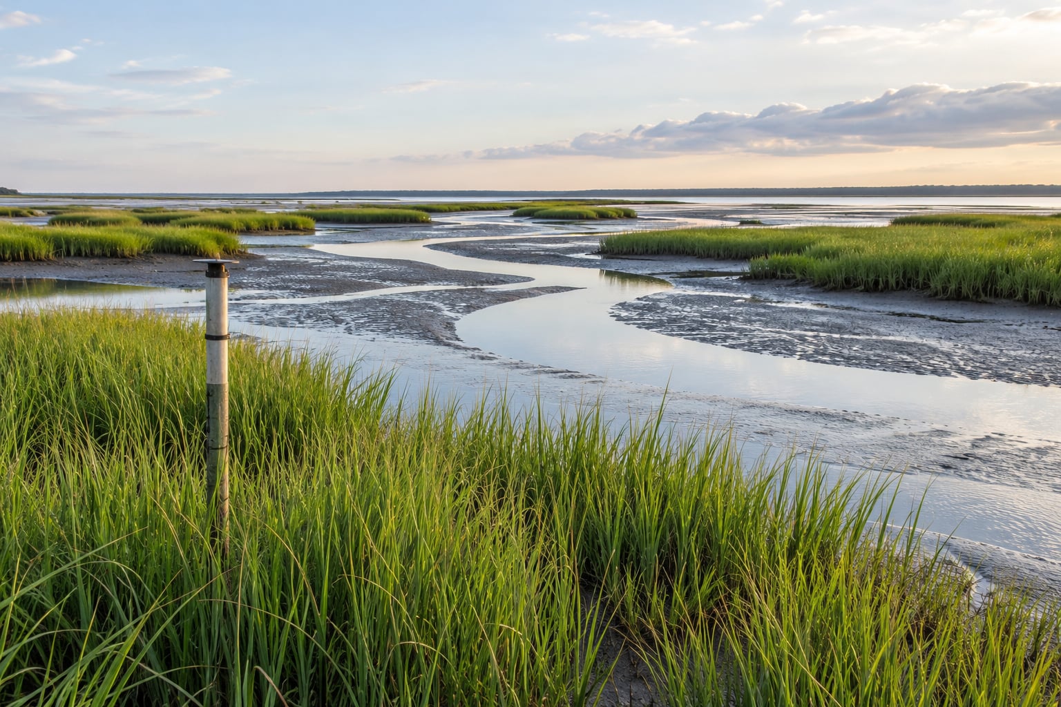
Sediment elevation tables (SETs) are the workhorse. A SET is a vertical pole driven into the marsh sediment, with a calibrated reference surface and a felting pad glued to the sediment surface around it. Quarterly readings give the elevation relative to a fixed benchmark, so you capture both deposition and compaction in one number. The Natural Areas Association has produced a widely used video segment on SETs for exactly this reason.
Surface elevation markers (SEMs) are simpler: a rod or stake with a fixed reference mark that tracks how the sediment surface rises relative to a known point.
Lidar produces a whole-marsh elevation surface at once, which is how surface elevation change is now mapped over large areas.
Sediment traps and plates give the flux arriving from overlying water, vegetation plots track aboveground and belowground production, and tide gauges provide the relative sea-level rise figure to divide by. When vertical accretion divided by local relative sea-level rise sits above one, the marsh is gaining; below one, it is losing.
What can people do to help salt marshes adapt?
Protection works better when it targets the adjustment mechanisms, not just the current shoreline.
- Protect the migration corridor. Conservation easements, zoning that lets marshes move onto former farmland, and removing hard barriers are worth more than fighting erosion at the existing edge.
- Restore sediment flow. Reconnecting tidal flow and breaching drainage ditches with dikes and aboiteaux return brackish water to places where it has been absent for decades.
- Use sediment budgets to decide. Thin-layer sediment placement sprays dredged material across a marsh in centimetres rather than dumping it in mounds. At Seal Beach National Wildlife Refuge, where oil and gas extraction had produced roughly 28 cm of subsidence, the pilot generally achieved a targeted 25 cm augmentation with substantial spatial variability.
- Protect the vegetation. Managing herbivory and crab damage keeps the trapping engine running.
- Cut nutrient and sediment pollution. Excess nitrogen and sediment change plant communities and deposit volumes in ways that reduce marsh elevation capital.
- Monitor, and keep monitoring. SET networks, vegetation plots and periodic lidar are how you learn early that a marsh is falling behind.
- Keep people off the vegetation. Trampling compacts the surface and destroys the root mat, which is why boardwalks exist at heavily visited marshes.
None of these is dramatic on its own. Together they decide how much of the marsh area survives this century, because the sites where protection has been put in early keep gaining while abandoned sites convert.
Frequently Asked Questions
How fast do salt marshes accrete?
Long-term monitoring puts many New England marshes below 2 mm/yr of surface elevation gain, while Gulf of Mexico marshes commonly gain 10 mm/yr or more where rivers deliver sediment. Numbers below about 2 mm/yr are widely cited as a threshold for trouble in southern New England and Long Island. Always compare local accretion with local relative sea-level rise rather than the global mean.
Can salt marshes survive sea level rise?
Some can, and many cannot. A marsh keeps up when its surface rises at least as fast as local relative sea-level rise, either through vertical accretion or by migrating onto higher ground. Under high-end projections many marshes convert to tidal flat or open water. The decisive factors are sediment supply, land subsidence and whether the inland corridor is still open.
What is a sediment elevation table?
A sediment elevation table is a monitoring pole driven into marsh sediment with a fixed reference point and a felt marker attached to the soil surface around it. Quarterly readings give surface elevation change relative to a permanent benchmark, capturing sediment deposition and compaction together. Researchers measure a fixed set of points because the marsh surface is uneven and self-compacting.
Why do marshes need to migrate inland?
When a marsh cannot build enough elevation, it can still survive by shifting onto higher ground as the seaward edge erodes and the landward edge colonises. This rollover keeps the marsh platform at a workable height relative to water. Seawalls, roads, drainage ditches and developed land block that corridor, forcing the marsh to rely entirely on vertical accretion.
Is adding sediment always good for a marsh?
No. A 2022 study in Science, based on elevation data from 97 tidal marsh sites across four continents, found that sediment accumulation drives subsidence in a non-linear way, and that marshes accreting faster than roughly half the local sea-level rise rate gained no net elevation. Sediment placement helps when matched to local rates and monitored afterwards.
What to do first
Start by finding out what is happening locally rather than trusting a global average. Divide local vertical accretion by local relative sea-level rise; if the number is near or below one, the marsh is falling behind.
Then check whether the inland corridor is open, because a blocked corridor turns a solvable problem into an engineering one. Where the corridor is still undeveloped, protecting it is cheaper than any sediment placement project, and it buys the marsh time to keep building elevation the way it always has.
This is also why how salt marshes keep up with sea level rise is not really one process but a choice about space. Sediment and plants do the slow work of raising ground. Land use decides whether they get the decades they need.