Wetlands are the cheapest flood insurance most towns never buy. Here is how wetlands reduce flood damage, what each mechanism actually does, and where the whole approach breaks down. Every year the United States loses a large share of its remaining wetlands to drainage, fill and shoreline development, and the flood bills tend to follow.
Table of Contents
- How Wetlands Reduce Flood Damage
- How Do Wetlands Store and Slow Floodwater?
- What Happens During Infiltration and Groundwater Recharge?
- How wetlands reduce flood damage through infiltration and soil storage
- How groundwater recharge and baseflow support flood protection
- Why Are Wetland Vegetation and Rough Ground Important?
- Which Types of Wetlands Offer the Best Flood Protection?
- Where Do Wetlands Fit in a River Basin?
- Can Wetlands Prevent Every Flood?
- How Can Wetlands Be Protected for Flood Resilience?
- Frequently Asked Questions
- Do wetlands really reduce flooding?
- Why can a restored wetland still flood nearby communities?
- Which wetlands protect against river flooding most effectively?
- How do wetlands help reduce coastal flood damage?
- How can local authorities measure the flood benefits of wetlands?
- Conclusion
How Wetlands Reduce Flood Damage
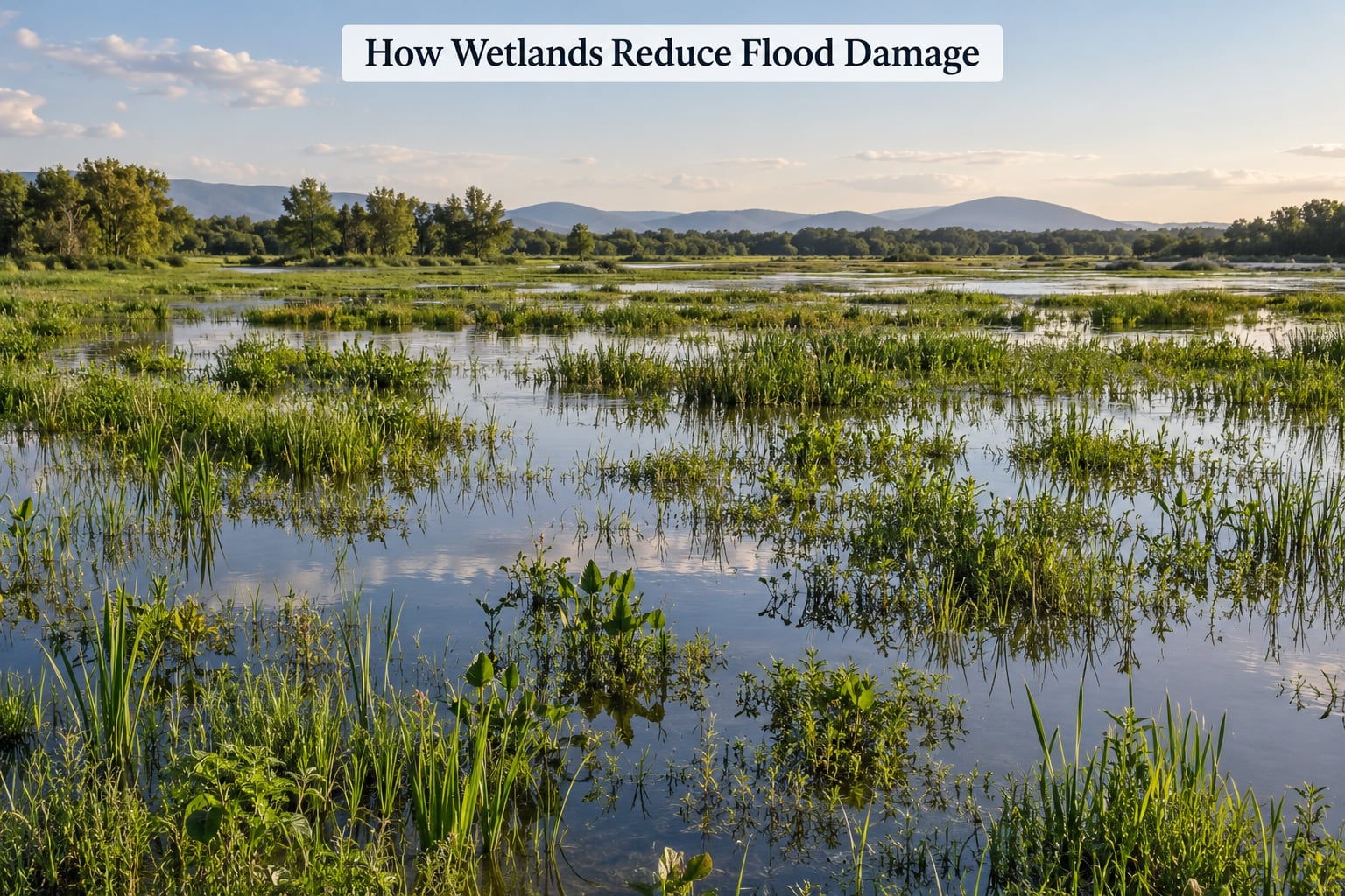
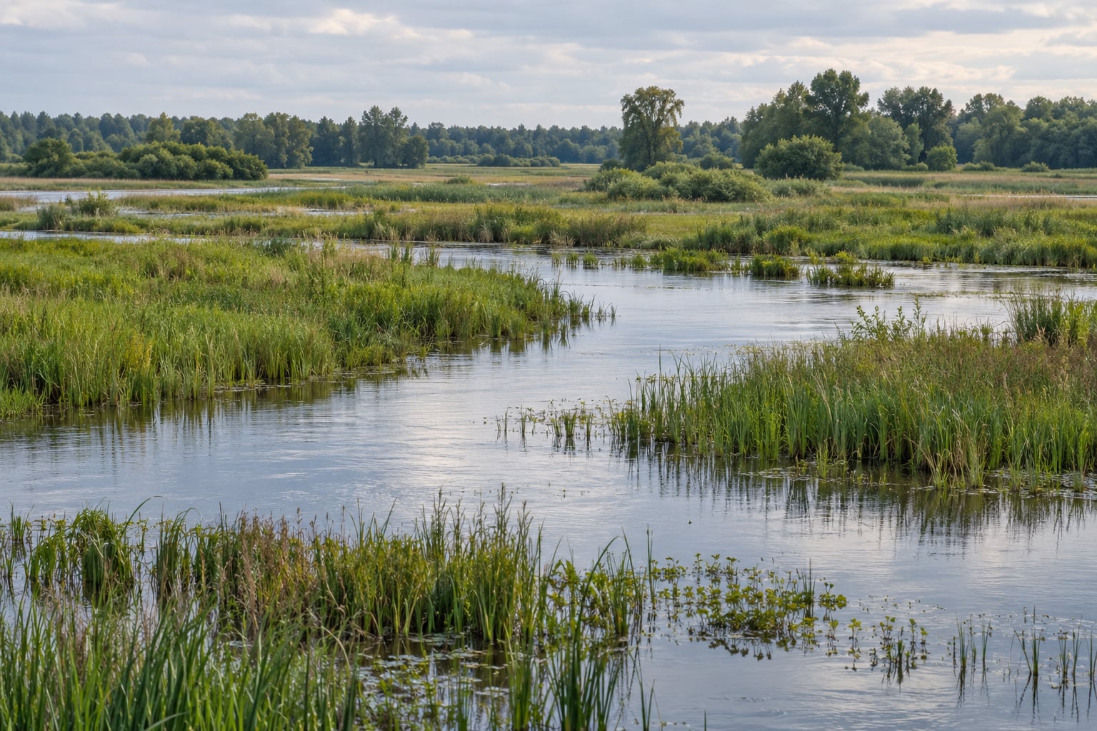
Wetlands reduce flood damage by temporarily storing water that would otherwise run straight off into rivers and streets, then releasing it slowly. Their soil, roots and stems slow the flow, let some water soak into the ground, and spread the remaining water across a wide, low surface where it does less harm than a fast channel full of it.
The capacity figure people quote most often is roughly a million gallons per acre of wetland, and about three acre-feet of storage under the right conditions. An acre-foot is one acre of ground covered by one foot of water, so three acre-feet spread across an acre means three feet of standing water, and across three acres it means one foot.
Four mechanisms do most of that work, and they overlap rather than replace each other:
- Storage — holding water on the land surface instead of routing it downstream
- Infiltration — letting water soak down through soil instead of sheeting off it
- Flow slowing — dragging the water’s speed down so peaks arrive lower and later
- Floodplain reconnection — giving rivers room to spread out and drop their load
| Mechanism | What it does | Where it matters most |
|---|---|---|
| Storage | Keeps water on the surface for weeks or months instead of hours | Seasonal marshes and inland floodplain wetlands |
| Infiltration | Moves water into soil and, from there, into groundwater | Wet meadows, floodplain forests with deep permeable soils |
| Flow slowing | Cuts peak discharge and adds lag time between rain and flood | Riparian wetlands and vegetated buffers along channels |
| Floodplain reconnection | Lets a river spread and drop sediment and water over a wide area | Restored riverine wetlands and setback levees |
Keep the four mechanisms in mind in that order, because they come up again in every section below.
How Do Wetlands Store and Slow Floodwater?
Different wetlands intercept water in different places, and the type tells you where in the flood event it does its work.
Seasonal wetlands fill from rain and snowmelt and empty through evaporation and plant use. They act as the first thing in the path, intercepting runoff before it reaches a stream.
Riverine wetlands sit along the banks and flood when the river climbs out of its channel. When a levee is set back, the river can spread into this land, slow down and drop its sediment instead of pushing against a wall.
Floodplain forests work like a very soft sponge. Trees take up water through their roots, wet soils hold the rest, and fallen trunks create small dams that slow current and trap debris.
Coastal marshes and mangroves take the first hit from storm surge and wave energy. They do not stop a hurricane, but they take energy out of the water before it reaches a road or a house.
Three measurements are worth keeping straight, because they describe different things.
Water level is how deep the water stands. A wetland that fills a foot deep over ten acres has absorbed ten acre-feet even though nobody is in danger of drowning.
Peak discharge is the largest volume of water passing a point per second. A levee concentrates flow and pushes the peak downstream; a wetland spreads the same water over a wider area and lowers that peak.
Flood duration is how long water stays above a given level. Wetlands often lengthen flood duration locally, which is not always good. That is why a restoration that adds water upstream without room to release it can make drainage problems worse.
What Happens During Infiltration and Groundwater Recharge?
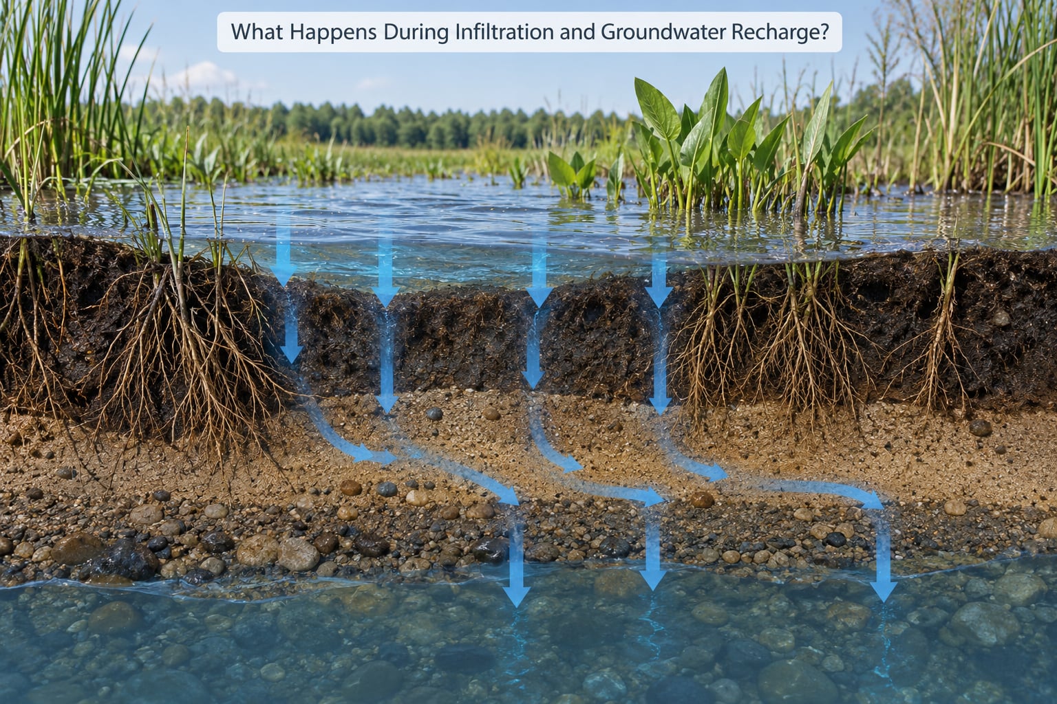
How wetlands reduce flood damage through infiltration and soil storage
Water that soaks into the ground is not in the street any more, and it does not add to the peak flowing downstream. In a healthy wetland, two features make that happen fast. Plant roots and burrowing animals leave channels through the soil, and microtopography built up over decades creates hummocks, ridges and depressions that pond water in low spots instead of letting it run across a smooth surface.
Sediment type sets the ceiling. Sands and gravels let water move down quickly. Silts and clays are far slower, and peat behaves oddly, holding enormous amounts of water in a permanently saturated state while letting almost none pass through.
The catch is prior saturation. A wetland that is already full cannot absorb much more, which is why the storage figures people quote describe a good day rather than a permanently available reserve.
How groundwater recharge and baseflow support flood protection
Infiltration does not just disappear underground. Much of it recharges groundwater, and groundwater feeds streams between storms. That is baseflow, and it is the quiet reason a basin with healthy wetlands often runs a steadier stream through the dry season.
Baseflow matters for flood damage in a roundabout way. When streams run low between events, there is more room in channels and soil to take the next burst of rain. When they run high all year, the same basin floods sooner.
Recharge also depends on depth to groundwater. If the water table sits close to the surface, incoming water has nowhere to go but up and out. Where engineers have drained a wetland or lowered the water table for farming, that path is broken.
Why Are Wetland Vegetation and Rough Ground Important?
Vegetation does something a concrete basin cannot: it makes the ground physically difficult for water to move through. Stems, roots, woody debris and hummocks create friction, and friction eats energy.
Picture two channels carrying the same storm. The first is straight, steep and bare, so the water arrives downstream fast, high and full of sediment that scours everything in its path. The second is a wide floodplain with sedge, willow and fallen logs, so the same water slows down, spreads sideways, drops its sediment and arrives hours later at a lower level.
The practical consequences are easy to trace. Rough ground traps sediment, so channels downstream stop choking. Vegetation holds streambanks together, so a flood does not widen a creek by ten feet in one night. Roots take up water and shade the soil, which keeps it from sealing into a hard crust that would refuse to absorb anything.
That is also why mowing a buffer down to bare dirt or paving a wetland edge removes flood protection long before anyone notices a drainage problem.
Which Types of Wetlands Offer the Best Flood Protection?
There is no universally best type. A wetland that is excellent for river flooding can be useless for a salt marsh on a shrinking coast, and vice versa.
| Type | Where it sits | Main flood function | Main limitation | Illustrative example |
|---|---|---|---|---|
| Freshwater marsh | Inland depressions, lake margins | Stores rainfall and snowmelt before it reaches streams | Small volume relative to big river floods | Restored prairie potholes intercepting spring runoff |
| Floodplain forest | River corridors, backwaters | Slows overbank flow, traps sediment, stores water in soil | Loses function if levees isolate it from the river | Orting, Washington, where floodplain reconnection cut local flooding |
| Riverine wetland | Along channels and in oxbows | Lowers peak discharge and adds lag time | Depends on room to spread; narrow corridors fill up fast | Backwater systems on large lowland rivers |
| Peatland | Flat, waterlogged uplands | Holds very large volumes for long periods | Once drained it oxidises and loses both storage and carbon | Restored peat commons rewetted after agricultural drainage |
| Estuarine marsh | Where rivers meet sea | Buffers tidal surges and traps sediment | Vulnerable to sea level rise and shoreline squeeze | South Cape May Meadows, which buffered homes during Superstorm Sandy |
| Mangrove | Tropical and subtropical coasts | Dissipates wave energy across a wide belt | Needs warm water, suitable sediment and time to grow | Mangrove belts that cut wave height in the first hundred metres of a surge |
Some of the strongest real-world evidence is where floodplain reconnection replaced a hard edge. In Orting, Washington, buyouts and reconnection allowed the river room again. In Cape May County, New Jersey, restored marsh and living shoreline buffered homes when Superstorm Sandy arrived.
Where Do Wetlands Fit in a River Basin?
A basin’s wetlands work as a chain. Headwater wetlands slow the rain that starts the problem. Mid-basin floodplain wetlands absorb and delay overbank flow. Coastal wetlands absorb what the river and the ocean hand them.
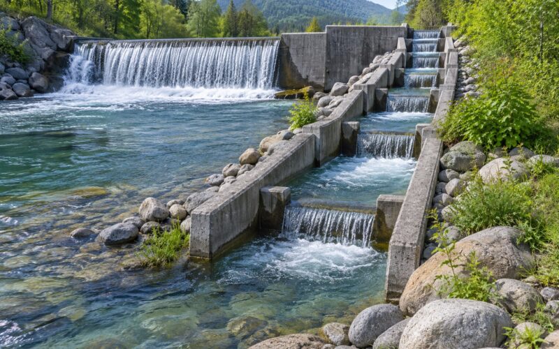
None of that replaces a levee, a reservoir or a warning system. Wetlands are the slow part of the response, and they work best when the rest of the system is designed with them rather than against them.
| Approach | Strength | Weakness |
|---|---|---|
| Wetland and floodplain restoration | Cheap over decades, self-maintaining, adds habitat and water filtration | Slow to build up, needs area, cannot handle extreme events alone |
| Levees and seawalls | Immediate, predictable, protects a defined line | Transfers water downstream, fails if overtopped or undermined, no habitat gain |
| Reservoirs | Stores large volumes with controllable release | Impassable terrain, sediment loss, evaporation losses in warm basins |
| Floodplain zoning | Takes people and new buildings out of harm’s way | Slow politically, requires compensation for landowners |
| Early warning | Saves lives at low cost | Does nothing for property once water arrives |
The economics usually favour doing both. Conservation of floodplain land has been measured at benefit-cost ratios around five to one in some US basins, and coastal wetlands are credited with an estimated 23.2 billion US dollars a year in storm protection services alone. Those are averages across regions, not a quote for your neighbourhood.
Can Wetlands Prevent Every Flood?
No. Wetlands moderate floods; they do not end them.
A one-acre wetland cannot absorb a river’s flood volume, and water released from a saturated wetland may arrive downstream at the same time as water from every other acre doing the same thing. Rainfall events that exceed the soil’s capacity and the ground’s storage will move past the wetland no matter how healthy it is.
Rapid coastal surge is a different problem again. Water arriving faster than the marsh can absorb still reaches the structures behind it, which is why mangroves and marsh belts are described as damage reducers rather than barriers.
Then there is drainage. A blocked storm drain or a culvert under a road constricts flow in a way no wetland can offset. Where that constraint sits downstream of the wetland, the wetland’s work is thrown away.
Effectiveness collapses when a wetland is drained, narrowed, embanked, polluted or cut off from its river. An embanked wetland that is no longer connected to floodwater behaves like a bathtub with a lid.
How Can Wetlands Be Protected for Flood Resilience?
Protection is mostly the unglamorous work of keeping water moving naturally through ground that is allowed to get wet. In 2026, the practical actions are these.
- Restore natural flows. Remove or set back embankments, breach drainage tiles and reconnect floodplain fields so rivers can spread during high water.
- Stop drainage and encroachment. Fill, roads, ditches and hard edges convert a sponge into a pipe. Land-use rules that keep development off floodplain land do more for flood damage than almost any engineering project.
- Protect water quality. Sediment, nutrients and trash fill the storage space that makes the wetland work and smother the plants that slow the flow.
- Watch the embankment question. A levee around a wetland removes its function. Where levees must stay, build them back from the water and treat the wetland behind them as habitat rather than as a sump.
- Give wetlands room to migrate. Coastal marshes trapped between a rising sea and a fixed road or wall lose area every year. Landward migration corridors and setback zoning keep them viable.
- Monitor condition, not just presence. Track hydroperiod, vegetation cover and channel connection. A wetland that survives on paper but is cut off hydrologically is not protection.
None of this should start with a landowner or a resident. Local hydrological assessment has to come first, because the same action that helps one site can push water onto a neighbour. If you are not sure whether your property sits on or near a wetland, ask your local planning or water quality authority before you dig, fill or build.
Frequently Asked Questions
Do wetlands really reduce flooding?
Yes, within their limits. Wetlands store water that would otherwise run straight to streams and streets, slow it down and let part of it soak into the ground. The effect shows up as lower peak flows and slower runoff, not as an end to flooding. Restoration also helps when the wetland is large, connected to its river and healthy.
Why can a restored wetland still flood nearby communities?
Usually because of scale, timing or connection. The storm exceeded what the soil and ground could hold, water arrived from every wetland in the basin at once, or the site was drained, embanked or cut off from its river so it never received floodwater. A wetland on the wrong side of a road embankment cannot do the job it was built for.
Which wetlands protect against river flooding most effectively?
Connected floodplain wetlands and floodplain forests do the most for river flooding, because they let overbank water spread out, slow down and drop its sediment. Inland marshes and wetlands intercepting rainfall upstream also help by holding spring runoff before it reaches the channel. Restored river corridors such as Orting, Washington, show what reconnection achieves.
How do wetlands help reduce coastal flood damage?
Salt marshes, estuaries and mangrove belts take the first hit from storm surge and dissipate wave energy across a wide, rough surface. They trap sediment, build land and reduce wave height before water reaches roads, seawalls and buildings. They lower damage rather than stopping the surge, so most coastal plans pair them with other defenses.
How can local authorities measure the flood benefits of wetlands?
Track hydroperiod, vegetation cover, flood storage volume and peak flow reduction at the site, then compare modelled flood levels with and without the wetland. Field sensors and aerial imagery show whether water is actually reaching the wetland, while stream gauges show what happens downstream. Repeated monitoring after storms reveals whether the benefit is holding up.
Conclusion
Wetlands are natural infrastructure. They moderate floods instead of eliminating them, and they work best as part of a plan that includes levees, zoning, drainage maintenance and warnings.
The first practical step is unglamorous: protect the wetland areas already connected to your river, and stop drainage and encroachment on them. From there, restore natural flows, keep monitoring, and be honest with your neighbours about what a wetland can and cannot do for a serious flood.