Why rivers run dry in late summer? Because a river’s annual water supply arrives in a short, cold-season window, then gets spent over the following months by heat, plant transpiration, drainage into the ground and human withdrawals. By August most channels survive on baseflow alone, and that supply is at its annual minimum.
That seasonal trough is normal. What is not normal is a channel that stays dry through a wet winter, or one that dries every August and never carried water in autumn twenty years ago. Telling those two situations apart is the whole game, and it takes more than a photo of a dusty riverbed.
Table of Contents
- Why Rivers Run Dry in Late Summer
- How Seasonal River Flow Works
- What Causes Low River Levels in Summer?
- Why Rivers Run Dry in Late Summer in Southern Spain
- How Climate Change Makes Dry Rivers More Common
- What Happens When a River Loses Its Water?
- Natural Low Flow or a Sign of Drought?
- What Can Be Done to Protect Low-Flowing Rivers?
- How to Read River Conditions in Late Summer
- Frequently Asked Questions
- Is it normal for rivers to have very little water in late summer?
- Does a dry riverbed mean the river is permanently dry?
- How does climate change affect late-summer river flow?
- Can dams and reservoirs cause rivers below them to run dry?
- What can people do when a local river reaches dangerously low levels?
- What to Do First
Why Rivers Run Dry in Late Summer
Late-summer low flow is the natural seasonal minimum of a river’s discharge. The spring pulse of rain and snowmelt has already passed through the channel, evaporative demand peaks during the hottest weeks, and groundwater that recharged the aquifer over winter is now being drawn down from storage.
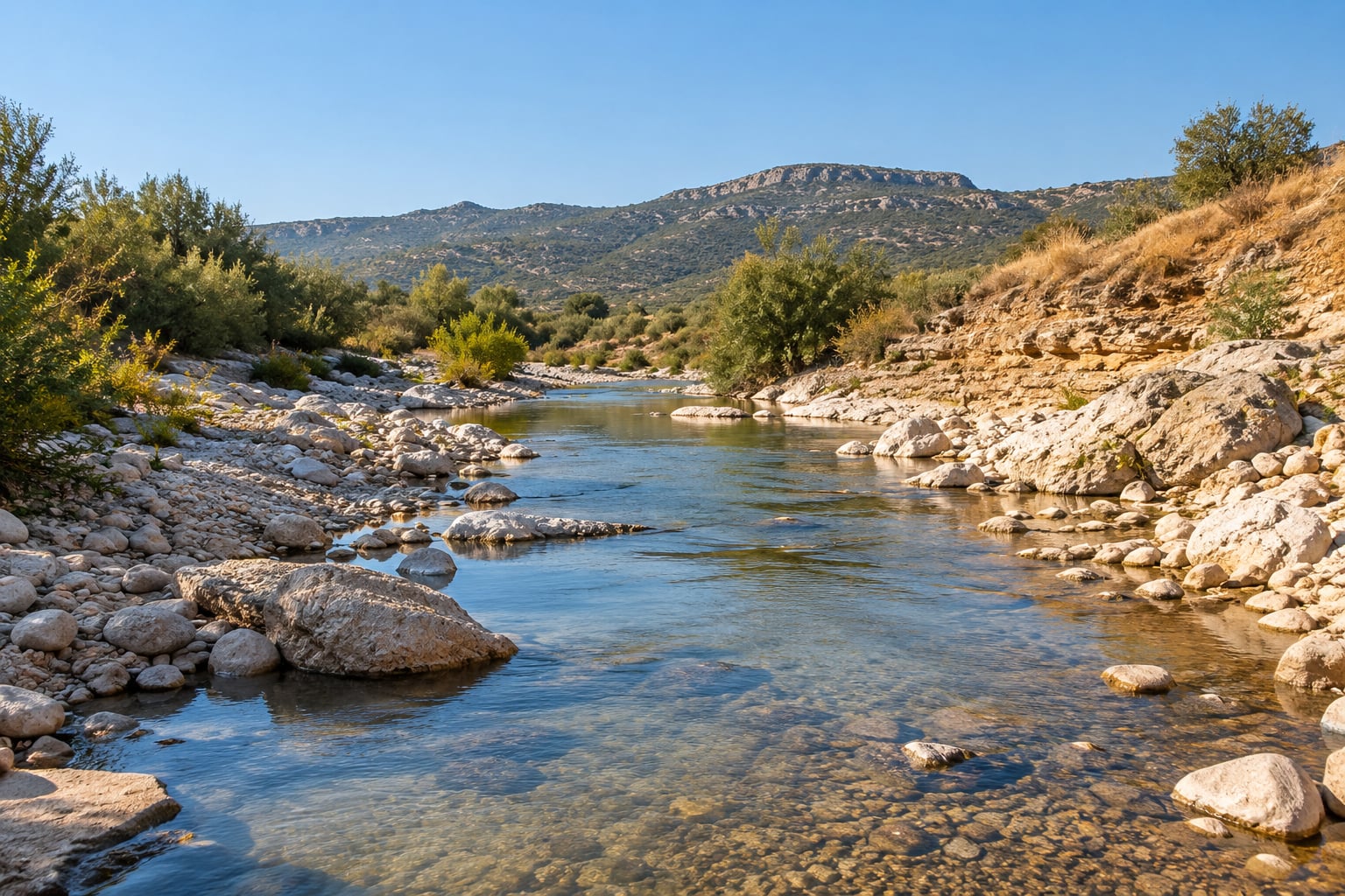
Two different things get called “drying”. Seasonal low flow is a river doing what it always does at the bottom of its annual curve, and a perennial river may shrink to a shallow braid of pools without ever going dry. Drought is a departure from that curve, and it is measured, not assumed: below-average rainfall for weeks, a gauge reading under the seasonal percentile, restrictions on abstraction.
The distinction matters because the remedies differ. A seasonal trough needs patience and planning. A drought needs demand reduction in the short term and catchment reform in the long one.
How Seasonal River Flow Works
Plot a year’s discharge against the months and you get a bell with a long, low tail, called a hydrograph. The peak arrives in spring, when snowmelt and frontal rain converge. The tail is what remains in August.
Three mechanisms shape that curve, and each one explains part of the late-summer decline:
- Front-loaded supply. Snowpack is a storage reservoir with a melt-out date. Once it is gone, the meltwater pulse is spent. A warm spring can finish it weeks early, leaving the rest of the summer relying on rain that may never come.
- Summer losses. In the heat of July and August, potential evapotranspiration is at its annual maximum. Open water, wet soil and leaf-on vegetation all send water back to the atmosphere, and the catchment nets out negative.
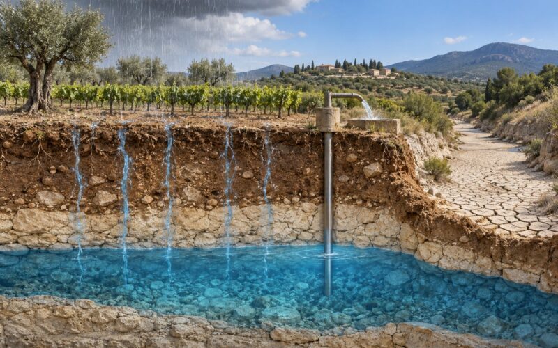
- Baseflow drawdown. Between storms, the channel is fed by groundwater that seeped into the alluvial bed and nearby aquifers. That baseflow declines through the dry season by design: recharge mainly happens in winter, when rainfall is frequent, cool and cheap to infiltrate.
This is why a dry winter is worse than a dry summer for the following August. Winter rainfall is what refills the aquifer. Summer rain falls on hot, dry soil that absorbs it quickly or sheds it straight to the sea.
The plain-language version of the question people ask most often, on forums and in classrooms, is simpler: if water flows downhill to sea level forever, why does the source ever run out? Because the water arriving at the sea is not the same water sitting in your river in August. Snow and rain in the upper catchment replace it continuously. When that replacement stops, the river is spending a finite store rather than receiving a supply.
What Causes Low River Levels in Summer?
Seven factors account for nearly every late-summer drying people notice. They usually stack, and the same river can be hit by three of them in the same year.
- The spring supply is already spent. Snowmelt and spring storms passed through weeks or months ago. Late-summer rain is treated as a bonus, not the main supply.
- Evaporative demand peaks. High temperatures, wind and vegetation drawing water through leaves remove more of the catchment’s water to the atmosphere in August than in any other month.
- Soils are empty. A soil moisture deficit means rainfall goes to wetting the ground rather than generating runoff. A storm can deliver 40 mm and leave the channel looking untouched.
- Groundwater tables fall. Pumping for irrigation and drinking water lowers the water table. When the water table drops below the streambed, seepage into the channel stops and baseflow falls away.
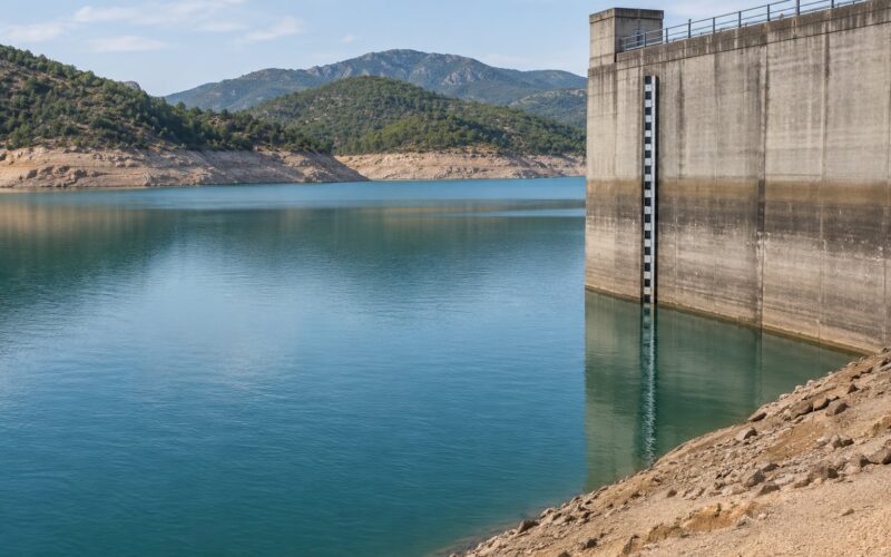
- Upstream abstraction and impoundment. Diversions for irrigation and municipal supply, plus reservoirs that hold water back for release later, remove flow from the reach below. On regulated basin rivers such as the Rio Grande, the immediate cause of a dry stretch is often a release schedule upstream rather than the local rainfall record.
- Rain shadow and geology. Mountain ranges block moisture, so leeward catchments are dry by design. Where the bed is coarse gravel or highly permeable sand, water percolates into a perched alluvial aquifer and the surface channel stops carrying any.
- Climate-driven shifts. Warmer winters, earlier melt and a shrinking snowpack shorten the window of reliable supply, so the late-summer low is now lower than it used to be.
| Cause | When it bites hardest | Who notices first |
|---|---|---|
| Snowmelt pulse spent | June to September | Alders and other downstream gauge readers |
| Peak evaporative demand | July and August | Crop irrigators, reservoir operators |
| Soil moisture deficit | After every dry-spell storm | Anyone waiting for a flood that never comes |
| Groundwater drawdown | Second and third dry year | Wells, pumping licence holders |
| Upstream abstraction | Peak irrigation season | River users, anglers, downstream intakes |
| Permeable bed, rain shadow | Whole dry season | Ecologists, drought refugia watchers |
| Climate-driven timing shift | Every year now, cumulatively | Everyone, via lower late-summer baselines |
Why Rivers Run Dry in Late Summer in Southern Spain
Mediterranean rivers follow the same physics with a narrower margin for error. Rainfall is irregular and concentrated in autumn and winter, so summer is a seven-month gap rather than a brief dry spell, and the Guadalquivir and Guadiana basins spend that gap drawing on stored water.
Orographic control shapes it further. Air arriving from the Atlantic is lifted over the Betic ranges and drops its moisture on the windward side, leaving Guadalete, Guadiaro and several smaller eastern basins in a rain shadow. Those rivers are low from late spring onward in most years.
Summer demand then peaks at the same moment. Irrigation for olives, citrus, vineyards and horticulture draws heavily from surface water and from wells in the alluvial aquifers, reservoir operators try to hold storage for autumn sowing, and repeated droughts push allocation thresholds lower each cycle.
A useful local detail: in permeable reaches the channel can look completely dry while water still moves beneath the gravel. A dry bed there is not an empty aquifer, and drilling beside it may still find saturated alluvium. That is also why one stretch stays wet while the next one a kilometre away has failed, depending on sediment grain size and depth to bedrock.
How Climate Change Makes Dry Rivers More Common
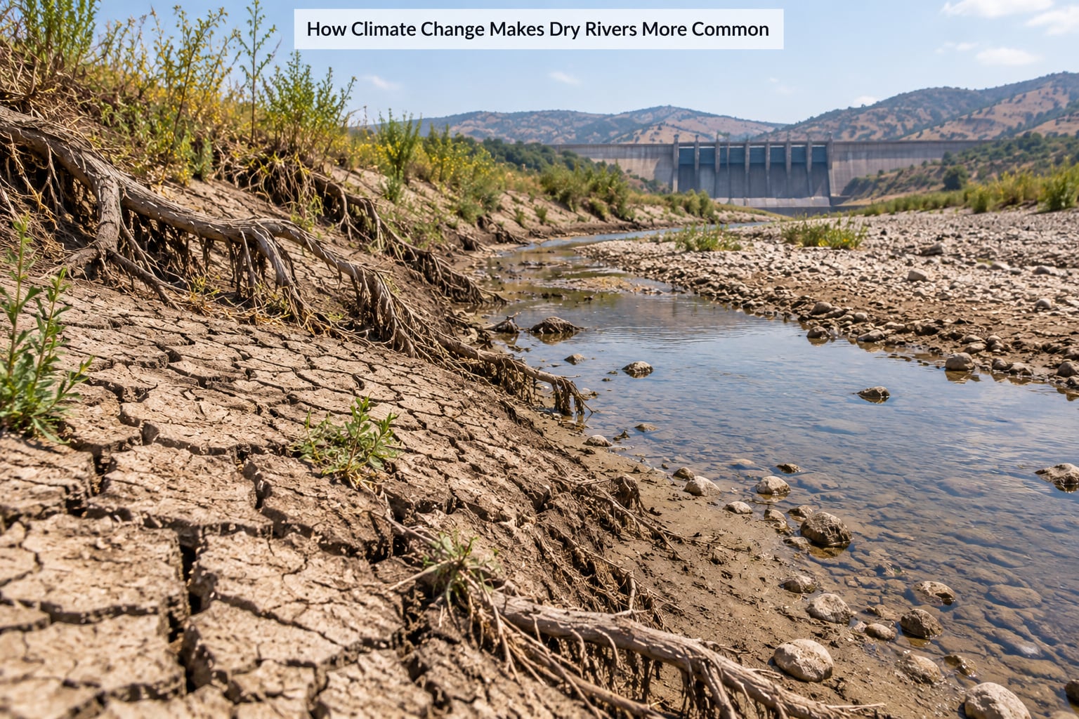
Climate change shifts the supply curve rather than switching it off. Warmer temperatures raise evaporative demand, so the same rainfall produces less runoff and a lower late-summer baseflow. Winter warming increases evaporative losses from snowpack before it melts, shrinking the snowpack that used to buffer August.
Timing moves too. Snowmelt is arriving earlier and peak runoff is moving earlier in the season, which shortens the period of reliable flow for anything that needs cold water through the summer. In Alberta’s mountain headwaters, a recent analysis of 21 gauge stations found August was the only month with widespread significant flow decreases, while winter and spring flows were stable or rising.
Attribution studies have found that human-induced warming made recent European summer droughts far more likely. That does not mean every low August has one cause. Natural multi-year variability, river engineering and abstraction still account for a large share of any individual event, and conflating them is where most public argument goes wrong.
There is historical context worth holding onto. Peer-reviewed work on English droughts from the 1200s to the 1700s documents recurring dry summers that dried watercourses, with real measurable consequences. Rivers drying in August are not new. What is changing is the frequency, the severity and the baseline they now return to.
What Happens When a River Loses Its Water?
The ecological bill arrives fastest where water is warmest and the fish are already stressed. As discharge falls, water temperature climbs, and warmer water holds less dissolved oxygen. Low flows also concentrate pollutants and nutrients in what little water remains, which is why fish kills cluster in late summer.
Cold-water species suffer most. Trout, char and their invertebrate prey depend on flows cold enough to hold oxygen. A reach that warms past tolerance stops being refuge even if it still has water in it, so isolated pools and shaded tributaries act as drought refugia where the fish concentrate.
| What is affected | What low flow does to it |
|---|---|
| Fish and aquatic invertebrates | Warmer water, less oxygen, crowding into pools, loss of cold refuges |
| Wetlands and floodplain pools | Shrink or dry out, cutting off nursery habitat for birds and amphibians |
| Riparian vegetation | Stress, leaf drop, dieback of trees that shade the channel and stabilise banks |
| Water quality | Higher concentration of nutrients, sediment and contaminants; temperature spikes |
| Recreation and access | Loss of wading, boating and fishing, plus exposed bed hazards |
| Groundwater recharge | Less water infiltrating along the channel during the recharge season |
| Downstream users | Intakes and irrigation offtakes run short when the river is already low |
Once riparian trees go, the channel warms faster and infiltration drops further. That feedback is why losing flow can become self-reinforcing rather than a one-season dip.
Natural Low Flow or a Sign of Drought?
You cannot tell from one visit. You need context, and most of it is public.
- Compare with the seasonal average, not with last year alone. A flow duration curve shows what percentage of the time a river flows below a given discharge, and most agencies publish their gauge record online.
- Check rainfall over the preceding months. Low flow with normal rainfall points toward abstraction or river engineering rather than weather.
- Read the temperature story. Much warmer than usual, with the gauge low, is a classic evaporative-demand signal.
- Look at upstream. Dams, irrigation intakes and bypassed reaches within a few kilometres tell you a lot. Danube watchers track named stations on the river’s gauges and compare each season against previous low years, and that habit of comparing years is exactly right.
- Ask about abstractions. Permit registers are public in most jurisdictions, and so are drought orders that trigger temporary limits.
A river that dries every August and refills with the first winter storms is doing what its catchment built it to do. So the seasonal answer comes first when people ask why rivers run dry in late summer, and only then the structural one. A river that stayed dry all winter, or that dried earlier each year for a decade, is telling you something structural.
What Can Be Done to Protect Low-Flowing Rivers?
Agencies hold most of the levers. Minimum environmental flow rules, which reserve water in the channel for ecology regardless of abstraction, are the single most effective measure and are used widely in European and Australian jurisdictions. Abstraction licences capped to sustainable limits, and licences that flex with drought stage, stop the low months from being raided hardest.
Leak reduction in distribution systems is unglamorous and effective. A utility that loses a fifth of treated water returns less to the river than any planting scheme will, and repairing mains during dry years is the cheapest way to add supply.
Drought planning done in advance beats emergency restrictions every time. Basin authorities who pre-agree staged cutbacks, triggers and communication with irrigators, municipalities and environmental groups can shorten the painful weeks when allocation begins.
Farmers have levers too. Shifting irrigation away from peak summer months, using drip or subsurface systems, keeping field margins and hedgerows that slow runoff, and using soil moisture sensors before irrigating rather than on a fixed calendar all reduce the demand that hits the river in August.
Riparian restoration helps on longer timescales. Planting willow, alder and tamarisk along the banks shades the water, stabilises the channel and slows erosion, but seedlings need groundwater or hand watering to survive the first two summers, which is why restoration programmes cluster along reaches where water is already reliable.
At household level, keeping rainwater for gardens and toilets, avoiding ornamental pools that need topping up in August, and following local restrictions promptly are small acts, but they add up across a basin.
How to Read River Conditions in Late Summer
You can learn a lot from a walk along the bank, without instruments.
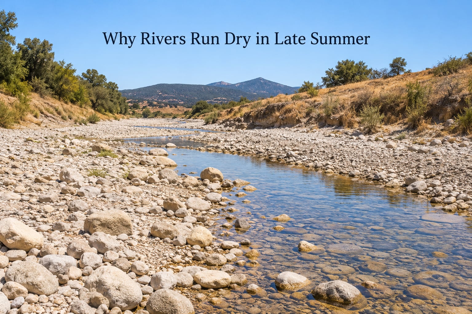
- Channel width versus water width. A wide pale bed of exposed stones with a narrow thread of water is a losing reach; the flow is going into the gravel.
- Pool depth and connectivity. Isolated pools with warm, stagnant water between them are a poor sign for fish.
- Water temperature. Touch is enough for a rough idea, but a clean thermometer is better. Warm water with full sun on bare gravel is the classic late-summer combination.
- Clarity and odour. Clear water is good. Cloudy, foaming or foul-smelling water suggests sediment or nutrient input, and that deserves reporting.
- Vegetation stress. Wilting riparian trees, dead fish and stranded invertebrates all point to a reach under pressure.
- Everything upstream. Note any pump, canal, bypass channel or construction work on the same reach.
Two cautions. Stay out of the water when low flows expose hazards, unstable banks and submerged debris, and never handle fish or samples that might be contaminated. Report fish distress, pollution and illegal abstraction to the relevant local water authority rather than trying to fix it yourself.
Frequently Asked Questions
Is it normal for rivers to have very little water in late summer?
Yes, in most climates the late-summer minimum is normal, because the spring snowmelt and rain pulse has already passed and groundwater baseflow is at its annual low. A perennial river normally shrinks into shallow pools rather than drying. Use the local gauge record to judge whether a given year is within the normal range.
Does a dry riverbed mean the river is permanently dry?
Usually not. A dry surface channel often hides water moving beneath coarse gravel in a perched alluvial aquifer, especially in permeable reaches. The river normally refills after winter rainfall, though it will refill sooner where abstraction is limited. Check for a flow-return date on the local gauge before assuming permanence.
How does climate change affect late-summer river flow?
Warmer temperatures raise evaporative demand, so less rainfall reaches the channel as runoff and less is stored for baseflow. Warming winters shrink snowpack and shift melt earlier, shortening the window of cool, reliable flow. Analyses of mountain headwaters find August is now the month with the clearest flow declines, though abstraction still drives many individual events.
Can dams and reservoirs cause rivers below them to run dry?
Yes, particularly when regulations prioritise storage over downstream release and when drought restrictions cut releases. Reservoirs also lose significant water to surface evaporation, which is largest in hot, dry, low-impoundment summers. Regulators can mitigate this with minimum environmental flows, but the pattern varies widely by basin.
What can people do when a local river reaches dangerously low levels?
Check official flow and drought notices before drawing water, follow any local abstraction limits, and report fish distress, pollution or illegal withdrawals to the local water authority. On a personal level, cut garden and pool top-ups, capture rainwater and support measures that protect minimum environmental flows, which is what most directly helps the channel.
What to Do First
Start with the data, not the photograph. Find your local gauge station, compare the current reading with the seasonal average, and read the abstraction register upstream so you know whether you are looking at weather, demand or both.
Then cut your own unnecessary withdrawals, respect any restriction in force, and report pollution, fish distress or illegal pumping to the local water authority rather than to social media.
Over a season, the useful habit is simpler than it sounds: check the gauge in January and again in August. Two numbers a year, kept for a few years, tell you whether your river is drying or just being a river.
Understanding why rivers run dry in late summer matters beyond curiosity. A late-summer channel is the honest scorecard for everything that happened to that catchment all year, and it is where restoration, abstraction reform and climate adaptation either show up or do not.